Wednesday, September 24, 2008

Ozark Highland Trail article in October 2008 National Geographic


A wonderful read with amazing photos... as you would expect from National Geographic. Tim Ernst is also interviewed. Check out the article here and the photos here. Make sure you scroll through the photos. There are 18 total.

Sponsored backpacking trip on the Ozark Trail


The Gateway Council of Hostelling International USA is sponsoring a backpacking trip on the Ozark Trail. The dates are Saturday, Oct. 11 to Saturday, Oct. 18 (half week trips are available). They will backpacking 30 miles on the Current River section and 20 miles on the Between the Rivers section. This is their 20th year of promoting the Ozark Trail through our backpacking adventure. More information can be found here.

Friday, August 29, 2008

Wilderness groups to hold conference focusing on forest protection

Friday, August 29, 2008 | 10:08 a.m. CDT

ST. LOUIS — Wilderness advocates will gather next week in Salem to plan the next steps of an effort to win federal protection for 50,000 acres of public land in Missouri's Mark Twain National Forest.

The Missouri Wilderness conference on Sept. 6 is aimed at starting to build public awareness and support of the proposal before approaching potential sponsors in Missouri's congressional delegation.

"We feel confident they will want to do this good deed for Missouri," said John Karel of the Missouri Wilderness Coalition, an assortment of conservation groups working for the designation.

Currently, 4 percent of the Mark Twain forest is designated wilderness, meaning it is free of roads, all-terrain vehicles, mining and logging, but open to hiking, camping, fishing, horseback riding, hunting, canoeing and picnicking.

The additional acres would bring the amount of land in the state with that kind of protection to 7 percent. Missouri's last wilderness designation was 24 years ago. The first was in 1976.

While 50,000 acres sounds like a lot, it's "an incredibly modest proposal," organizer Scott Merritt said. The entire forest is 1.5 million acres.

"They're a rare resource worth protecting," Merritt said.

The coalition's proposal is for seven wild places that advocates say are vulnerable - Big Spring, Lower Rock Creek, North Fork, Smith Creek, Spring Creek, Swan Creek and Van East Mountain.

Karel said the areas were identified by conservation groups years ago, and, until recently, had special protection as "sensitive areas" under a settlement agreement with the U.S. Forest Service.

But the 2005 Forest Service plan dropped the sensitive area status, prompting conservationists to seek federal wilderness protection.

Karel said the wilderness areas are very popular with the public and heavily used.

The biggest hurdle may be winning over the Republican congresswoman for southeast Missouri where five of the proposed wilderness areas are located.

Rep. Jo Ann Emerson said she strongly opposes the proposal and believes it would hurt her constituents.

The group wants to meet with Emerson to discuss the proposal.

Mark Twain Deputy Forest Supervisor Paul Strong said the Forest Service did not recommend the areas for wilderness, but instead designated them as "semi-primitive, non-motorized."

He said the "semi-primitive" designation would allow the agency to do limited burning and logging to permit the growth of plants that would naturally grow in the environment.

Sen. Kit Bond, R-Mo., said he would look at the proposal and consider the views of all stakeholders.

"I cannot support any proposal that does not have the clear support of local citizens and all affected members of the delegation," he said.

"Also, many have expressed concern with the impact this plan would have on good forestry management."

In 1976, Missouri's first wilderness legislation was passed, designating Hercules Glades in Taney County and the Mingo Swamp in Wayne County.

Between 1976 and 1984, about 100,000 acres, most of them in the southern Ozarks, were declared wilderness areas. Almost 64,000 acres of Missouri's wilderness areas are already in the Mark Twain National Forest.

Besides Hercules and Mingo, the state's other existing wilderness areas include Bell Mountain, Rockpile Mountain, Devil's Backbone, Paddy Creek and Irish Wilderness.

Strong said that because wilderness requires a hands-off management approach, Hercules Glades are at risk of being overrun by Eastern red cedar trees.

"That's the trade-off," he said.

Tuesday, May 02, 2006

Routinely filling reservoir three inches from top

An article published by the St. Louis Post Dispatch reviews the 239-page report from the staff of the Federal Energy Regulatory Commission, the agency that regulates the Taum Sauk Hydroelectric Plant. In the report it was found that key instruments had been failing for months. These intruments were extremely important as reservoir was routinely filled within 3 inches of the top.

Sunday, April 30, 2006

Taum Sauk trail update from John Roth

posted to MOTRAILS

I spoke with DNR this weekend about the status of the Taum Sauk trail, which is currently closed through Johnson Shut-Ins.

The long-range plan is to build a new through-hike bypass from the scour area at the base of Proffit Mountain, up the next ridge and through a scenic and rugged area overlooking the Shut-Ins, then down to the Black River to reconnect with the existing trail north of the lower reservoir. This portion of the trail will be scoped out in the coming weeks/months, and (cross your fingers) built with the OTAs help in the fall. This will be a neat section of trail.

The short-term plan is still uncertain. There was hope to obtain an easement through private land on the old Boy Scout trail to take the trail off Proffit down to Highway N and terminate at a new parking lot just north of the entrance to JSI. Easements are land contracts and problematic, and it just isn't going to happen quickly, so this option isn't viable by May 27th, which was DNR's original target date.

Another option is to rebuild the damaged trail through the scour or just above the scour, then connecting to either a new trailhead at Highway N or to an interpretive trail in the remodeled JSI park. Since the park is going through major renovations, and some of the designs are still fluid, it will require more time to finalize this route.

The positive news is that the rebuilding of the damaged trail is still a priority with DNR. But it's going to take some more time. I'll update the ozarktrail.com website and this group with information as it becomes available.

In other news, MDC had a controlled burn on Proffit three weeks ago, and the trail there is really tough to find. Work is ongoing to reestablish this route. You should avoid this area until it's cleared and new markers are hung.

A social trail has developed between the Goggins 'equestrian' trail and the Taum Sauk trail atop Goggins. DNR is considering officially placing a trail here, allowing hikers to travel from the Highway A trailhead at Bell Mountain Wilderness to the Goggins trailhead on Highway MM. Several people from this group have already hiked this route.

I think that's it for now. Any questions I can't answer I'll forward to DNR.

John (john.roth@gmail.com)

Saturday, April 15, 2006

200 miles of continuous Ozark Trail


Several newspapers have picked up the latest AP article (and this April 20th article) on the completion of the Middle Fork section that now make it possible to hike over 200 continuous miles on the Ozark Trail. A small amount of OT history is mentioned.

Tuesday, April 04, 2006

Johnson's Shut-Ins State Park to reopen by Memorial Day

An article on the AP (and this one in the Post) says Johnson's Shut-Ins will be reopened by Memorial Day however on a limited basis. You will only be able to view the shut-ins and hiking is still prohibited in work zones. Meetings have been setup to take public opinions on the park's restoration plans.

Park plan meetings:

The Missouri Department of Natural Resources will hold three more public
meetings this week on the future of Johnson's Shut-Ins State Park. They will
run from 4 to 7 p.m.

Today at the Department of Natural Resources conference center, 1738 East Elm
Street, Jefferson City

Today at the Farmington High School cafeteria, 1 Black Knight Drive, Farmington

Wednesday at the St. Louis County Library's Oak Bend Branch at 842 South Holmes
Avenue

A stream restoration plan for the east fork of the Black River in the park will
be presented at the library at 7 p.m. Wednesday.

An online survey also is available at www.mostateparks.com/jshutinsdamage.htm.

Thursday, January 19, 2006

Taum Sauk Area Threatened By Hydro Plant

Once in a while, I find the perfect piece that captivates my outdoor senses. This article captures the struggle between preservation and development and clearly describes the time and area's history. The article was reposted on MOTRAILS from yet another board and was originally written in 2001 in response to a proposal by Ameren for further development.

TAUM SAUK AREA THREATENED BY HYDRO PLANT
by Dr. Susan Flader


When state park officials selected a cover photo to illustrate their first-ever assessment of "threats to the parks" nearly a decade ago, they chose not a scene of despoliation but a symbolic representation of the best of what they were seeking to protect. It was a vista at the core of the Ozarks, looking from the state's grandest waterfall near its tallest peak across its deepest valley into the heart of Taum Sauk Mountain State Park, Missouri's then-newest public park but also its geologically oldest, wildest, most intact, and most ecologically diverse landscape.

Scarcely could one imagine that the very symbol of what they were seeking to protect through their threats study, titled "Challenge of the '90s," would itself become the most seriously threatened landscape in Missouri at the dawn of the new millennium. The photo showed two forest-blanketed, time-gentled igneous knobs in the heart of the St. Francois Mountains, on the left Smoke Hill, recently acquired by the state, and on the right Church Mountain, leased to the Department of Natural Resources for park trail development by Union Electric Company of St. Louis (now AmerenUE). But on June 8, the Ameren Development Company, a subsidiary of Ameren Corporation, filed an application for a preliminary permit with the Federal Energy Regulatory Commission (FERC) for the Church Mountain Pumped Storage Project. It would consist of a 130-acre reservoir ringed by a 12,350-foot-long, 90-foot-high dam on the top of Church Mountain, a lower reservoir of 400 acres formed by a 1,900-foot-long, 100-foot high dam flooding several miles of Taum Sauk Creek, which has been designated a State Outstanding Resource Water, and associated tunnels, powerhouse, transmission lines, roads, and related facilities.

Leaders of the Missouri Parks Association, who have examined the proposal in the context of the resource values within the potentially impacted lands, consider this project the greatest threat to any unit of the park system in the nearly two decades of MPA's existence.

To be sure, the Ameren application seeks a preliminary permit-not one to authorize construction but a 36-month permit to proceed with economic and environmental studies and prepare engineering plans, including the drilling of boreholes and construction of access for drilling equipment.
* * *

The region near the forks of Black River, including Taum Sauk and Church Mountains, was once part of the largest land grant ever made by French or Spanish authorities in Colonial Missouri. The Catholic priest at Ste. Genevieve, Father James Maxwell, was awarded four leagues square-150 square miles-in 1799 for the purpose of settling destitute Irish Catholics that he would rescue from "British tyranny" in order to help populate the interior of the territory. This was Missouri's original "Irish Wilderness," six decades before Father Hogan's Irish settlement in Oregon County. But the area was too inaccessible. Though Maxwell's heirs continued to litigate the unconfirmed grant as late as 1875, it remained remote and largely unproductive, sparsely settled by hardscrabble hunters and farmers who ran their stock on open range until the state finally outlawed the practice in 1967. The bottomlands along Black River were tillable and hence more heavily degraded by settlers and their stock, but the interior from Proffit and Church Mountains to Taum Sauk, including its principal drainage, Taum Sauk Creek, retained much of its biotic integrity.

When conservation sentiment began to sweep the country in the first decades of the twentieth century, this area at the heart of the St. Francois Mountains was recommended for acquisition as national forest in a 1914 federal reconnaissance. In the same year, a state senatorial committee investigating potential sites for state parks recommended two tracts totaling more than 15,000 acres in this area, in addition to Onondaga Cave and Ha Ha Tonka. Missouri lagged behind many other states in acquiring public conservation lands, however; it was not until 1924 that it began to purchase its first state parks-mostly big Ozarks springs-and it was the depression '30s before the state authorized purchase of national forest land, which nearly surrounded but did not include the Taum Sauk area.

In the 1940s, Leonard Hall proposed a 60,000-acre roadless wilderness preserve in the St. Francois Mountains, in a grand arc from Bell and Lindsey mountains in the north through Goggins on the west to Proffit, Church, Taum Sauk and on, but the plan faltered owing to multiple ownerships. Meanwhile, Joseph Desloge of St. Louis had persistently over the course of seventeen years assembled more than 2,300 acres and two miles of river frontage on the east fork of Black River that the Desloge Foundation donated to the State Park Board in 1955 as Johnson's Shut-Ins State Park, the first substantial tract in the Taum Sauk region in public ownership. That same year, the Conservation Department acquired Ketcherside Mountain State Forest east of Taum Sauk, and the park board continued its efforts to secure at least a portion of the 1.5 billion-year-old pink granite Elephant Rocks to the north, which had been suggested as a state park as early as 1924. A 135-acre remnant of the site would finally enter public ownership in 1966 as a gift from St. Joe Lead Company geologist John Stafford Brown.

Some time in the mid-1950s, Boy Scouts from Pilot Knob and Festus and their leaders began laying out a 28-mile trail through this rugged terrain from Elephant Rocks to Fort Davidson in Pilot Knob (which would become a state historic site in 1967), over Shepherd and Russell Mountains to Taum Sauk, then down to the base of Mina Sauk Falls, through the Devil's Toll Gate and west along Taum Sauk Creek for three miles, fording the creek some twenty times before ascending the south flank of Proffit Mountain, then down Sugar Camp Hollow to the East Fork Black River and Johnson's Shut-Ins State Park. The "Taum Sauk Trail" was dedicated in April 1958, and since then the "wildest walk in Missouri" has been a seminal experience in the lives of well over 25,000 Boy Scouts and countless others who have here taken the measure
of the Ozarks and of themselves.

In the midst of this rediscovery of the wilderness and recreational values of the Taum Sauk region and the beginnings of public commitment to the area's preservation, the Union Electric Company became interested in the possibilities of storing excess power for periods of peak demand through a pumped storage hydroelectric plant. The technology, which had been used in Europe and Japan but seldom in the United States, resulted in a net energy drain, requiring about 3 kilowatts to pump the water uphill for every 2 kilowatts of hydroelectricity produced, but it could be profitable owing to the difference between peak and non-peak rates. UE did not initially focus on the St. Francois Mountains, however; rather it began its search for sites at Lake of the Ozarks, where it already had a ready-made lower reservoir. But for various reasons, including the distance from the St. Louis load center, they turned their attention to sites nearer St. Louis, settling by 1956 on Establishment Creek near the Mississippi River in Ste. Genevieve County. When that proved infeasible owing to geological deficiencies and the routing of the new Interstate 55, it occurred to them that they could get by with smaller reservoirs if they had the greatest possible head of water. That led them inevitably to the St. Francois Mountains.

Taum Sauk Mountain at 1772 feet is the highest point in Missouri, and Taum Sauk Creek flows through the deepest valley (in terms of elevation differential). We don't know why UE avoided Taum Sauk, but we can imagine that they appreciated the extent of public interest in this spectacular area. Instead they settled on nearby Proffit Mountain, which would accommodate a 55-acre upper reservoir, and, for a 395-acre lower reservoir, the East Fork Black River just below the new Johnson's Shut-Ins State Park. In December 1959 they awarded a construction contract and began quietly but quickly to purchase land-some 3,600 acres in 38 different tracts. Even before completing land acquisition they began construction of road access and leveling the mountain top, blasting and quarrying rock to the floor level of the reservoir and using the quarried granite for the reservoir walls.

In the late '50s and early '60s, UE operated in a relatively benign political environment. There was apparently no significant opposition to the project from conservation organizations or anyone else, but that is hardly surprising. This was the greatest era of water development project construction in U.S. history and most people regarded such projects as virtually unstoppable. Moreover, what organizational capacity there was in Missouri at the time was engaged in trying to find an alternative to proposed dams on the Current River, an effort that led by 1964 to establishment of the Ozark National Scenic Riverways. As further indication of the decision making environment at the time, we may note that Union Electric completed construction of the project and dedicated it in October 1963 before hundreds of dignitaries who arrived on a special train from St. Louis-all while still arguing in the courts with the Federal Power Commission (FPC) over whether a federal license was required for the project. It was, the U.S. Supreme Court decided in 1965, but by then the plant was a fait accompli.

Even as the Taum Sauk plant was being brought on line, however, a controversy began over licensing of another, even larger pumped storage project at Storm King Mountain on the Hudson River that would permanently alter the decision making environment for such proposals nationwide. Scenic Hudson Preservation Conference, a coalition of conservation groups, intervened in FPC licensing proceedings against the Consolidated Edison application and, when FPC granted the license, took the case to court, winning a landmark decision in 1965 that required the FPC to consider scenic and historic values equally with economic values. Though hearings and litigation would drone on for fifteen more years before Con Ed finally abandoned the project and donated the land for a park in an out-of-court settlement, the 1965 precedent clarified the public interest in natural and cultural resources, guaranteed citizen groups the right to argue for protection of environmental interests in court, and led in 1969 to passage of the National Environmental Policy Act.

In Missouri it would require several decades for conservationists, biologists and government officials to begin to appreciate the magnitude of wild land and ecological values at stake in the Taum Sauk area. Realization began to dawn as a result of roadless area surveys and natural area inventories initiated throughout the state in the 1970s. The former, which led to the designation of the 9,000-acre Bell Mountain Wilderness in 1980, impressed on conservationists the extent to which wild land had become a finite resource in Missouri. And the latter, which involved especially intensive study of state parks, revealed that Johnson's Shut-Ins had a more diverse array of plant species than any other park in the state, with over nine hundred recorded species of trees, shrubs, vines, grasses, wildflowers and ferns. A new emphasis on ecosystem management, supported by increased interest in conservation biology and restoration ecology, began to penetrate most federal and state land-managing agencies by the late 1980s, and with it came a heightened interest in and concern about biodiversity and the negative consequences of landscape fragmentation on neotropical migrant songbirds and other species of plants and animals. By this time it was becoming understood that the Ozarks, especially at its core in the St. Francois Mountains, was a major center of endemism and biodiversity of national and even global significance.

Later in 1993, the park division acquired nearly 5,000 acres of wild land immediately west of Johnson's Shut-Ins, including all of Goggins Mountain and part of Bell Mountain, funded by a $1 million gift from the Richard King Mellon Foundation's American Land Conservation Program. The new tract was contiguous with the Bell Mountain Wilderness on the Mark Twain National Forest and it already contained twelve miles of the Ozark Trail, which had been developed in the mid-1980s from Bell Mountain all the way to Taum Sauk. Virtually the entire Goggins addition to Johnson's Shut-Ins was designated a State Wild Area (Missouri's largest) in 1995.

In recent years DNR has sought to acquire additional private lands in the vicinity, including two tracts along Taum Sauk Creek for which they were negotiating when it was rumored, in spring 2001, that AmerenUE had acquired them under threat of condemnation and was studying the feasibility of constructing a second pumped storage reservoir on Church Mountain. Not until the application for preliminary permit became available in mid-July could the dimensions of the proposed project be confirmed by DNR, MPA, or other concerned parties, even though it is now clear that some park land on Church Mountain would be directly impacted by the dam for the upper reservoir and other park land along Taum Sauk Creek would be flooded.
* * *

Since the Governor and DNR have not yet taken an official position on the Church Mountain Project, it remains for concerned citizens to express their views on the project's potential impact on public interest values in the area to state and federal officials as well as to Ameren.

Some who are aware that there is already one UE hydro plant in the area wonder whether a second one nearby would make much difference. The existing upper reservoir-named Taum Sauk even though it is on Proffit Mountain-is 55 acres, compared with 130 acres and more than double the generating capacity for the Church Mountain project. Moreover, the existing reservoir is on a secondary summit of Proffit Mountain and it is hidden from many vantage points by Church Mountain and by the higher dome of Proffit to the north. By contrast, Church Mountain has only one dome and it is directly in the line of sight from virtually everywhere, especially from Taum Sauk Mountain and Mina Sauk Falls, visited by thousands of people every year who seek "the wildest vista in the Ozarks." It is also visible from nearly everywhere along the Ozark and Boy Scout trails, from both the valley and the high country.

The existing lower reservoir on East Fork Black River south of Proffit is not visible from anywhere in the interior of the Taum Sauk area, while the new reservoir on Taum Sauk Creek would be visible from virtually everywhere. Moreover, it would flood out more than a mile of the historic Boy Scout trail in the valley, making it impossible to use a route that most scouts and many other hikers prefer to the higher Ozark Trail, because of the beauty of the creek and access to water, shade, less rugged terrain, and a three-mile shorter route from Taum Sauk to Johnson's Shut-Ins. If the new reservoir fluctuates as much as the existing one, up to fifteen feet twice daily in hot weather, it could also be a hazard to recreationists.

Even more destructive to the public interest than the massive impact on esthetic, cultural and recreational values would be the ecological impact of major fragmentation in the highest quality area that could be identified in Missouri in which to preserve a landscape-scale mosaic of the natural communities that make this part of the Ozarks one of the greatest centers of biodiversity on the continent. The impact on the aquatic and riparian communities in Taum Sauk Creek valley would be devastating-and this is a stream that retains a more natural riparian zone than practically any stream in the Ozarks, including the East Fork Black River, which was always more accessible to settlement and livestock. The St. Francois Mountains Natural Area and Church Mountain itself, which ecologists believe is of equal quality, is thought to be more important for the preservation of biodiversity even than Johnson's Shut-Ins, with its more than 900 plant species, because it has suffered less disturbance and has been much less fragmented. Although the area has yet to be studied as intensively as Johnson's Shut-Ins, it is known to harbor at least seven state-listed species of conservation concern, including the
federally listed Mead's Milkweed.

The current proposal by Ameren to decapitate Church Mountain and drown the valley of Taum Sauk Creek would violate not just a pleasant Ozark ridge and hollow-it would gut a key visual and natural heritage resource of all Missourians. This situation might seem to doom Missourians to an inevitable and disastrous confrontation between one of the most powerful and respected utility companies in the state, on the one hand, and the united voices of civic and conservation responsibility on the other.

We dare to hope that it need not be so. Whatever planning considerations led Ameren to broach this preliminary proposal, it is only reasonable to assume that it was done without a full and acute awareness of the enormity of the heritage values that would be destroyed. The responsibility now lies with all of us to bring these factors to their attention, forcefully but respectfully. Only preliminary plans have been drawn up. There is plenty of time for Ameren to withdraw this plan and find alternatives. Ameren can in fact emerge from this issue with a heroic act of public citizenship to its credit. That is our hope. That is our goal.

(This article was first published in Heritage, the Newsletter of the
Missouri Parks Association, August 2001)

Thursday, January 12, 2006

Risking arrest to snag a few photos of JSI

I ran across this website called Image Patch. You could spend a good deal of time here looking at the various beautiful scenery but what is really interesting, these are the first detailed photos of the Johnson's Shut-Ins damage that were Not taken by the State. The photographer was quickly kicked out of the park as it is currently closed. Now I need to look up the other photo locations and hike them out!

Monday, January 09, 2006

Another update from the DNR

Dear Missouri State Park Friends:

Welcome to the January issue of Missouri State Park eFriends. I wanted to provide you with an update on the status of Johnson's Shut-Ins State Park. First, I would like to thank everyone for the overwhelming support that the park and our staff have received. It is truly gratifying to see how much Johnson's Shut-Ins State Park means to you.

In an effort to keep the public informed on progress at the park, the department will hold regular public meetings. The next meeting will be at 7 p.m. Thursday, Jan. 12, at the Lesterville High School, located at Highway 21 and Elm in Lesterville. We hope to hold these meetings the second Thursday of each month.

We have now moved into the recovery stage for the park. The Department of Natural Resources, working with other agencies, is continuing to evaluate damage to the park's natural and cultural resources as well as its structures. Crews have already begun cleanup of debris and sediment, which covers much of the effected area of the park. Once immediate environmental issues are addressed, we will begin working on long-term strategies for recovery.

The main area of the park remains closed while cleanup and recovery continues. The department hopes to have some services available by summer but it is too soon to say exactly what that will be. The goal is to move as quickly as possible but not so fast that the future of the park is negatively impacted.

Our superintendent, Jerry Toops, and his family have returned to the Lesterville area. All three children have been released from the hospital and the family is doing well. They have been overwhelmed with support and donations, and I know they appreciate them all.

Keep watching the Web site for news about progress at the park, including updated photographs. You can follow along with some of the recovery phases of the park through these photographs. Go to http://www.mostateparks.com

Doug Eiken, Director
Missouri Department of Natural Resources
Division of State Parks

Thursday, December 22, 2005

Update on Johnson's Shut-Ins State Park and Ozark Trail damage

I received this email today:

Welcome to a special edition of Missouri State Park eFriends. We wanted to take this opportunity to update you on the status of Johnson's Shut-Ins State Park.

On Dec. 14, the Taum Sauk Reservoir near Lesterville failed, sending more than one billion gallons of water into Johnson's Shut-Ins State Park. The flooding caused extensive damage to the area of the park along the East Fork of the Black River where most of the park's facilities are.

Facilities receiving extensive damage include the campground, the water and wastewater systems, the boardwalk along the shut-ins and the superintendent's residence. Other structures received damage as well, including the park store and office. Mud and debris cover much of the area, including within the shut-ins area itself. A portion of the Taum Sauk Section of the Ozark Trail between Johnson's Shut-Ins State Park and Taum Sauk Mountain State Park was damaged and is closed.

The Department of Natural Resources, working with other agencies, has begun an evaluation of the damage to the park's cultural and natural resources as well as its structures. Once any immediate environmental issues are addressed, we will begin to determine the best method of cleanup and recovery.

Park superintendent Jerry Toops and his family lost their home when the flood occurred and his three young children were hospitalized. The two younger children have been released from the hospital but the oldest one, who is five years old, remains hospitalized. Several donation accounts have been set up to assist the Toops family, who lost everything in the
flood.

Johnson's Shut-Ins State Park remains closed until further notice but we are committed to rebuilding and reopening the park. It is too soon to determine when this might be.

The Goggins Mountain hiking and equestrian trail and trailhead, which is located in a different area of the park, remains open. All other state parks and historic sites in the area were undamaged and remain open.

For more information about the park and the recovery effort, please visit the Web site at www.mostateparks.com. The Web site includes before and after photos of the park, and updated information on the situation. This Web site will be updated on a regular basis to keep everyone informed of the progress.

Thank you for your continued support of the state park system. I will continue to send you updates on the progress at the park through eFriends and you can always receive more information through our Web site.

Doug Eiken, Director
Missouri Department of Natural Resources
Division of State Parks

Friday, December 16, 2005

Pictures of the Taum Sauk Reservoir damage

Pictures have been posted on the Missouri State Park's Johnson's Shut-Ins website of the severe damage as well as before and after shots.

Many dramatic pictures and video as well as the reservoir history can be seen on the St. Louis KSDK website. An earlier story with more pictures and video can be found here.


A 600 ft section of the reservoir gives way releasing over a billion gallons of water.


The water stripped the side of Profitt Mountain of trees and soil.


The water then rushed through Johnson Shut-ins and on down the Black River valley destroying a home, damaging trees and sweeping vehicles off the roads.

Wednesday, December 14, 2005

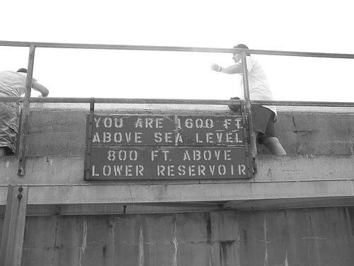
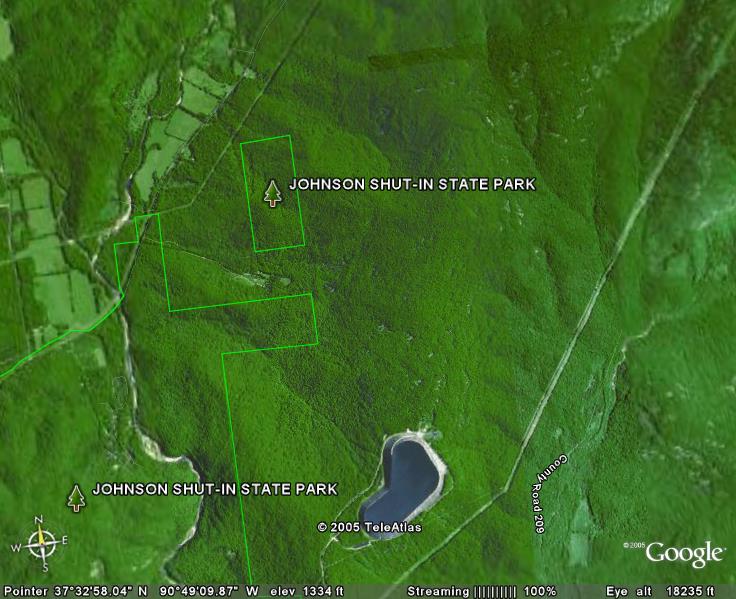
prior to Taum Sauk Reservoir failing (cracks and all)

Visitors on top of the Taum Sauk Reservoir
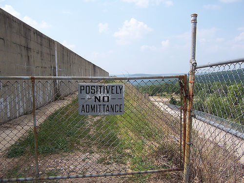

High security!


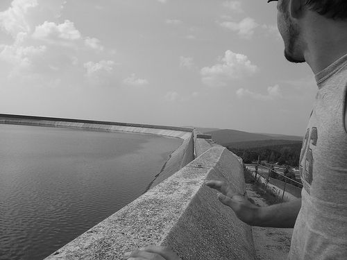
A view across the reservoir

Taum Sauk Reservoir breaks and floods Johnson Shut-ins


A breaking news report: the reservoir above Johnson Shut-ins has broken and washed out the park. There isn't much info yet... I'll update here when I get more.

Information regarding the reservoir can be found here and at this point is all over the news and other blogs.

Here's a good report of the damage and injuries. I'm still searching for any pictures of the are post accident.

Wednesday, November 30, 2005

Forest Service releases Mark Twain management plan

11/23/2005
ALAN SCHER ZAGIER

Associated Press

COLUMBIA, Mo. - Visitors to the Mark Twain National Forest can expect more intentional fires, a greater emphasis on habitat restoration and largely unchanged limits on timber harvesting under a new management plan released Wednesday.

The revised plan seeks to strike a balance between economic interests and environmental protection, said Randy Moore, a regional supervisor with the U.S. Forest Service. The federal agency manages the 1.5-million acre forest, which sprawls across parts of 29 counties throughout southern Missouri.

"The Mark Twain National Forest is uniquely positioned to provide abundant multiple uses while conserving the ecology and culture of the Missouri Ozarks," Moore wrote in a report outlining the new plan.

Federal scientists and regulators looking to update the forest's current plan, adopted in 1986, considered five alternatives. The options ranged from a ban on commercial timber harvests to retaining the status quo.

As expected, the Forest Service adopted a plan it called "Alternative 3."

That option will classify 29 percent of the forest as habitat worthy of restoration to its natural state while doubling the number of acres burned over the next decade - a technique also used to promote habitat restoration.

Timber industry lobbyists objected to the increase in prescribed burning, a practice first used by American Indians centuries ago to improve their access to food and shelter.

"This is not the natural forest," said Jerry Presley, a consultant to the Missouri Forest Products Association and former director of the state Department of Conservation. "It is a condition they have arbitrarily decided to create."

Environmental groups, in turn, said they are disappointed the Forest Service didn't appreciably change the limits on timber harvesting.

The new standard is 103 million board feet of wood per year; the current limit is 105 million board feet annually, though harvests from the past several years have produced only about half that amount.

"The Forest Service puts it forward as a compromise of interests, but I think that's a real dodge from the issues," said Jim Scheff of the St. Louis-based Missouri Forest Alliance. "That's not how the public wants its national forests managed."

Presley, though, noted that several federal laws authorize timber sales in national forests, a practice he said also promotes ecological diversity.

"Timber management is good for wildlife purposes," he said. "It creates (favorable) conditions for certain kinds of species. If you just let the forest grow naturally, you're going to lose some of those amenities."

Forest activist Jim Bensman of Heartwood Forestwatch, which has sued the federal agency numerous times for what it calls a lax regulatory stance, said his group is already working on an administrative appeal of the Mark Twain decision - a precursor to a lawsuit.

"It probably will be an exercise in futility," he said.

The revised plan also extends areas of the forest where livestock grazing is prohibited and suggests 13 areas for consideration as designated wilderness areas.

One topic it does not address in detail is the use of off-road vehicles in the forest. A separate environmental analysis of a proposal to temporarily expand off-road access in designated areas of the Mark Twain forest will be released early next year, said Ronnie Raum, the forest's Rolla-based supervisor.

The complete management plan can be found on the Web at http://www.fs.fed.us/r9/forests/marktwain.

Tuesday, September 13, 2005

Ozark Trail Service: Sept 25-Oct 1

The American Hiking Society has another Volunteer Vacation sponsored by the Ozark Trail Association. Work will be on the Middle Fork section of the Ozark Trail. The much anticipated completion of this section will open up 200 miles of continuous trail through Missouri. Volunteers will tent camp at the Council Bluff Recreation Area 20 miles southwest of Potosi, Missouri. The crew will drive to the work site each morning. The hike in will be one-half mile or less. Food is provided. The cost is $120 ($95 for members of the AHS). Additional work events can be found on the official OT website.

Friday, September 09, 2005

John Roth to speak to hikers


According to the Hot Springs Village Voice, John Roth, President of the Ozark Trail Association, will be the speaker at the Oachita Mountain Hikers evening meeting to be held September 15th at 6:00 PM at the Garland County Public Library. To learn more about the hikers, check out their web page. John Roth who has coordinated Ozark Trail maintenance for several years has been mentioned before on this blog and has his own blog here.

Monday, August 15, 2005

A jaunt up Missouri's top mountain

PETE GRATHOFF
Associated Press

ARCADIA, Mo. - At long last, the peak is in sight.

It has been more than seven hours since we set out, and my hiking companion is panting like a dog. Earlier, I had to carry her as we worked toward the summit.

But now, we walk together and reach the top of Taum Sauk Mountain, the highest point in Missouri. My hiking companion is Molly, a 3-month-old shepherd-Lab mix. Her tongue hangs out of her mouth, and she gazes up at me as I declare, "We're standing on top of Missouri!"

The Kansas City Star's Outdoors editor, Brent Frazee, said the time had come for a hiking story, one that would require a great deal of physical exertion.

He suggested I go.

This actually is the kind of assignment I love, because the rougher the trail, the farther away it is from civilization. The stuff I had read on the Taum Sauk section of the Ozark Trail sold me, particularly the 13-mile stretch from Johnson's Shut-Ins to the high point of Missouri: Taum Sauk Mountain.

It is preferred by those who routinely hike the Ozark Trail.

"It's probably my favorite section of the trail, because of the scenery and the water features and the rock formations," said Steve Coates, president of the Ozark Trail Association. "The views from the top of those hills are what's most impressive to me."

For some, the trouble with the views is you can't enjoy them without first undertaking a healthy climb. It's easy to scoff at the notion of scaling a mountain in Missouri, whose highest peak at 1,772 feet ranks 41st in the nation. By comparison, California's Mount Whitney is the highest point in the continental United States at 14,494 feet.

OK, so you won't need oxygen tanks. But the hike from Johnson's Shut-Ins crosses Proffit and Taum Sauk mountains and has climbs of roughly 2,000 feet and a descent of nearly 1,000 feet before all is said and done.

"It can be a pretty grueling hike with the footing the way it is. It can be tough," Coates said. "Then as you hike across those glades, they're very open and exposed, and the rocks tend to heat up. Those rocks can be 10 degrees warmer than it is around and really get pretty hot."

But not as hot as they once were.

"That's all remnant igneous rock right there," Coates said. "Those are the St. Francis Mountains, and those are old, old remnant volcanoes, so there is a form of granite down there that's called dolomite. It's kind of an iron-based rock that gives it its reddish color, and you see a lot of that down there, and some of the habitat is rather unique. I just love it."

On this particular summer day, there wasn't anything too out of the ordinary to see in terms of the wildlife: deer, turkeys and skinks. But there were a fair amount of black-eyed Susans, and the landscape is the best part of this hike.

The Black River runs close to the trail in parts, and you must cross it at one point just before it feeds into the Johnson's Shut-Ins. The water flows among the huge, smooth rocks, creating natural water slides..

How the Shut-Ins were formed is quite a story.

According to the Department of Natural Resources, it all began more than a billion years ago when hot volcanic ash and gases spewed into the air, cooled, and formed igneous rock. Later, shallow seas covered the rock, depositing sedimentary rock. The land rose. The sea fell. The weather began tearing down the land, exposing the volcanic rock beneath it.

Waters of the Black River became confined, or 'shut in,' to a narrow channel. Waterborne sand and gravel cut deeply into the erosion-resistant rock, carving potholes, chutes and spectacular canyonlike gorges.

Yet that means little when a sweaty hiker reaches the Shut-Ins.

"It's a lot of fun to climb around on those rocks and kind of lay in those pools and let the water splash over you," Coates said. "It's really refreshing."

It should be noted that dogs are not allowed at the Shut-Ins, so our hiking party did not partake in that pleasure.

The Shut-Ins aren't the only natural wonder on the hike. Perhaps just as well known is the Mina Sauk Falls, the highest waterfall in Missouri.

Mina Sauk was named for the daughter of Piankashaw Indian chief Taum Sauk. According to the Missouri Department of Conservation, legend has it the falls were formed when Mina threw herself off the mountain after her people had killed her Osage lover in a similar manner. The Great Spirit sent a bolt of lightning, which split the mountaintop, and water flowed over the ledges, washing away the blood of the lovers.

In the spring, blood-red flowers called Indian pinks grow along the banks of the stream.

Mina Sauk Falls drops 132 feet over three rocky outcrops. On our hike, however, it was bone dry because of a recent drought.

Less than two miles from Mina Sauk Falls is yet another interesting geological formation: the Devil's Tollgate, an 8-foot-wide passage through volcanic rock standing 30 feet high.

"That was an old road basically," Coates said. "Actually, I've been told it's an old Civil War road, too. That was a spot where the trail is kind of wide right through there, and it's the old roadbed. It's a good marker to say, 'Meet us at the Devil's Tollgate,' and historically, I'm sure a lot of events have taken place there through the course of time. It's a really, really neat place."

Supposedly, Jesse James hid out at Taum Sauk, so who knows, maybe there's some little-known history to the area as well.

But it's doubtful that he knew Taum Sauk would one day be considered a gem for hikers, a place that draws people for the quiet, the challenging climbs and the view.

Molly and I were impressed, even if she pooped out. Perhaps it wasn't wise to take such a young pup, because the hike is not to be taken lightly.

"It's very rugged, a lot of rocky footing and a lot of open glades," Coates said. "But especially in early spring ... you can see some really neat vistas."

Sunday, May 01, 2005

Palmer advocacy

Dale Hallett has written a couple of articles on the protection of Palmer an old mining town located in the Mark Twain Nation Forest. His article Forest Service ORV Study slams the Forest Service's idea of opening land to ATVs and argues safety and additional stress on an already taxed local fire department. Make sure you check out the links at the bottom to Take a Ride Through An Offroad Park and See What They Intend To Do To Palmer
and Hell on Wheels. Maps of the proposed study areas can be found here. In Dale's next article Environmental Impact Statement Due he discusses inadequate enforcement but also gives the side of the Forest Service. Dale was also published in The Journal with a similar article.

Good reads!

Wednesday, April 27, 2005

Yes, it's still FREE!

A nice article was published in the Kansas City infoZine entitled Experience Southeast Missouri on a Weekend Trip to Missouri State Parks and Historic Sites. There isn't much here on hiking or the Ozark Trail but I think it's great they drove the price home. Free free free free!